Buyers comparing Long Beach to the inland South Shore usually arrive with one number in hand. In July 2026, the Long Beach list-price median sat near $799K with a 54-day median time on market, and the March 2026 sale-price median printed around $738K, up roughly 8.5% year over year. Those are the figures the portals surface. They are also the figures that hide the second monthly line item that actually separates one Long Beach block from the next.
That line item is flood insurance. And since FEMA implemented Risk Rating 2.0, the premium is no longer priced to your block. It is priced to your specific structure, using variables you can partially influence before you sign a contract and cannot influence at all after.
The thesis, stated plainly
Two Long Beach homes on the same street, at the same list price, can carry monthly costs that differ by three hundred dollars or more. The gap is not about the neighborhood, and it is not about the flood zone printed on the FIRM. It is about how the algorithm reads the structure, how high the lowest floor sits, and whether the buyer walked in with a document that lets the carrier rate the property on evidence rather than assumption.
Risk Rating 2.0, in one paragraph
The old NFIP model priced by zone. The new one prices by property. NFIP rates are based on FEMA's Risk Rating 2.0 methodology, which considers distance to water, elevation, and rebuild cost, not just the FEMA flood zone. On a barrier island, being on a barrier island is itself a rating factor, which is why identical elevations in Long Beach and in an inland AE community do not produce identical premiums.
The variable explaining most of the gap between two neighboring Long Beach homes is not where the house sits. It is how it was built, how high it stands, and what the algorithm decides it would cost to replace.
How Long Beach's zones translate into monthly reality
FEMA designates virtually all of Long Beach as Zone AE, which encompasses the vast majority of the city and requires flood insurance for any federally backed mortgage. Long Beach also carries substantial Zone VE mapping along the barrier-beach frontage, the coastal high-hazard designation that accounts for wave action on top of flood depth, and VE properties carry the highest NFIP premiums and face the strictest construction standards for new development and substantial improvements.
| FEMA zone | Where it shows up in Long Beach | What it means for the buyer |
|---|---|---|
| VE | Oceanfront and barrier-beach frontage | Highest NFIP premiums; strictest build standards; elevation certificate essential for accurate rating |
| AE | The bulk of the city, including canal-front and interior blocks | Mandatory flood coverage on a federally backed mortgage; BFE drives premium |
| X (shaded) | Limited pockets between the 100- and 500-year boundaries | Not mandatory under federal lending rules, but Sandy pushed water into shaded X blocks anyway |
For context on scale, FEMA counted 95,534 buildings flooded, damaged, or destroyed across Nassau and Suffolk during Sandy, with Nassau accounting for 74,736 of those structures, and the post-storm analysis found that in Nassau County, 89 percent of the actual flooded area fell within the high-risk zones on revised maps, meaning the remaining 11 percent flooded outside them. Buyers looking at a shaded X parcel and assuming zero flood exposure are reading the map, not the storm history.
The 15 percent the City already negotiated for you
This one belongs on the pre-offer worksheet. The City has lowered resident flood insurance premiums by 15 percent for eligible policy holders through the CRS program, currently holds a Class 7 rating, improved from Class 8 after Sandy, and continues to work toward Class 6. That discount attaches to eligible NFIP policies inside city limits and does not follow you to a comparably mapped parcel in a non-CRS community. It is one of the reasons the Long Beach carrying-cost math is not the same as, say, an unincorporated South Shore hamlet with similar elevation.
The City of Long Beach's flood page is worth bookmarking before you tour, both for the zone lookup pointer and for the CRS documentation your carrier will want on renewal.
Where the $250,000 NFIP cap starts to bite
The moment a Long Beach purchase moves above roughly $1M in replacement cost value, the NFIP ceiling becomes a design constraint. Coverage maxes out at $250,000 for the dwelling and $100,000 for contents, which is fine for most homes but leaves a real gap on higher-value properties.
For West End cottages and canal-front rebuilds carrying replacement values well past that ceiling, the practical answer is a private flood policy layered on top of, or in place of, the NFIP baseline. Private carriers write to higher limits and often price competitively for well-elevated structures. The rating is still driven by the same underlying evidence: elevation of the lowest floor, distance to the shoreline, and the replacement cost the carrier assigns.
The Elevation Certificate is your only pre-offer lever
Here is the piece that separates prepared Long Beach buyers from the ones who re-model the deal in the parking lot. An Elevation Certificate is prepared and sealed by a licensed surveyor and shows the base flood elevation alongside the proposed or finished-floor elevation. Without one, the carrier's algorithm estimates first-floor height for you. Estimates, on a barrier island, tend to be conservative in the direction that costs you money.
Before you write an offer on a Long Beach home in AE or VE, get answers to these five questions in order:
- Does the seller already have a current Elevation Certificate, and can you review it before the appraisal?
- What is the finished-floor elevation relative to the current Base Flood Elevation, including any local freeboard requirement?
- Has the structure been elevated post-Sandy, and if so, do the plans and final CO reflect the compliance path?
- Is the current owner carrying an NFIP policy, and can it be assumed at closing rather than rewritten at today's rated premium?
- What replacement cost value is the current carrier using, and does that number push the property above the NFIP $250K/$100K limits?
If the seller has no Elevation Certificate, the typical Nassau County range runs roughly $500 to $950 to commission one from a licensed surveyor. That is often the highest-return spend in the entire transaction, because it converts the flood premium from an assumption into a documented number a lender and a carrier will both accept.
One more mechanism buyers underweight: under NFIP rules, rate increases for existing policyholders are capped annually, and primary homes see much smaller annual rate increases than secondary homes, with the increases applied each year until the policy reaches the true risk rate. Translation for a second-home buyer in Long Beach: the assigned policy on a beach condo is a near-term benefit, not a permanent one. Model the premium at the full Risk Rating 2.0 number and treat the assumed policy as a soft landing, not the destination.
The substantial-improvement rule that surprises renovators
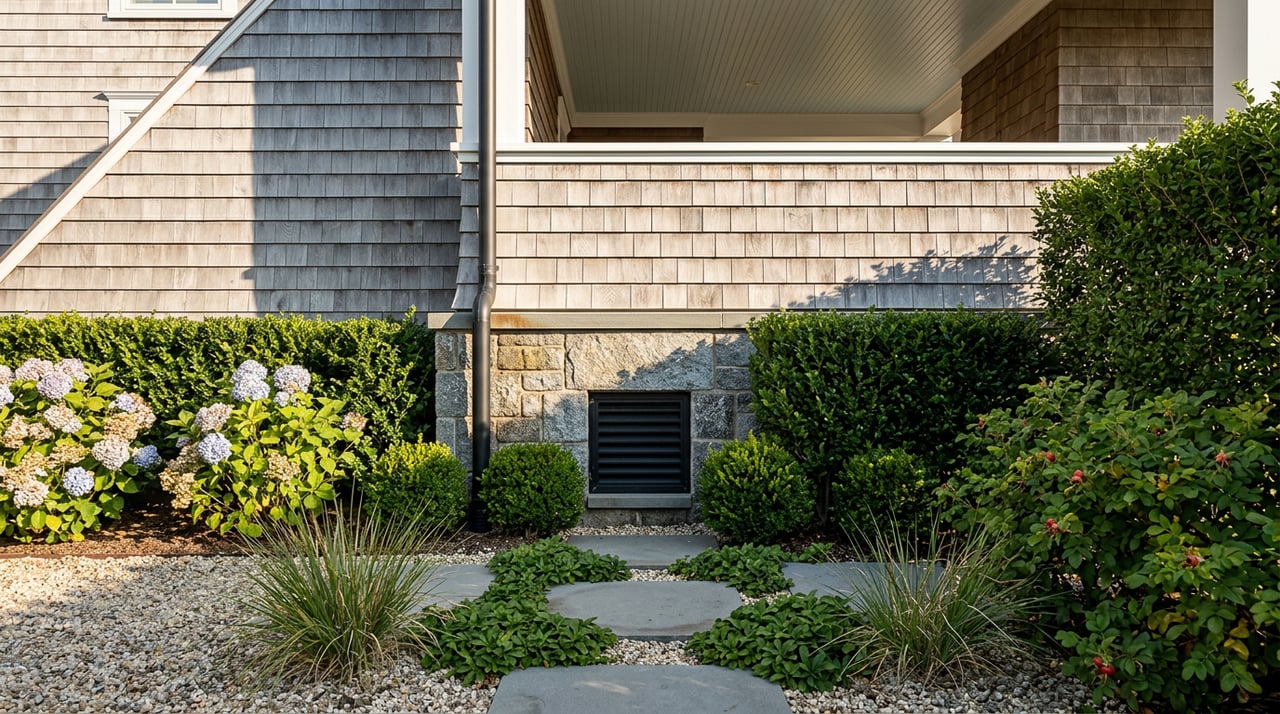
If your plan is to buy in Long Beach and renovate, the number you need to memorize is fifty percent. As the Long Beach Building Department floodplain rules enforce and NFIP guidance defines, work that equals or exceeds 50 percent of the building's market value triggers the substantial-improvement threshold and requires the structure to meet current elevation standards. That can mean piles, piers, elevated mechanicals, and flood vents on a home you bought expecting a kitchen refresh.
Robyn's own guide to permits for Long Beach elevations and major renovations walks through the documentation path in detail, including the elevation certificate, the freeboard question, and the CO paperwork lenders and title companies will look for.
The transaction friction here is timing. A buyer who plans a phased renovation over three years can accidentally cross the 50 percent line on the second phase and inherit a compliance obligation the first phase did not trigger. The cost of the second phase then quietly doubles.
A short FAQ
Does Long Beach flood insurance follow the buyer at closing, or restart? Existing NFIP policies can often be assigned to the buyer at closing, which preserves the current premium temporarily. New policies are rated fresh under Risk Rating 2.0 and take up to 30 days to bind, which matters for closing timelines.
Is a shaded X-zone Long Beach parcel safe to skip flood coverage? Federal lenders will not require it. The Sandy record and the FEMA claims data both suggest that treating shaded X as risk-free is a modeling error rather than a defensible plan.
How much can an Elevation Certificate actually move the premium? It depends on how far the lowest floor sits above or below the Base Flood Elevation. On well-elevated Long Beach structures, the documented number is often materially lower than the algorithm's estimated one. On non-elevated homes, the certificate at least gives you a defensible baseline for a private-market quote.
Does the CRS Class 7 discount apply to private flood policies? The 15 percent CRS discount attaches to eligible NFIP policies. Private carriers price on their own rating engines, though many will factor a strong Elevation Certificate into their quote.
Working with Robyn
The Long Beach median is a starting point, not a decision. The number that decides whether a specific home fits your monthly budget lives in the Elevation Certificate, the current declaration page, and the CRS documentation, and none of those show up on the listing sheet. If you are weighing a Long Beach purchase against an inland South Shore option and want the full monthly carrying cost modeled honestly before you write an offer, Robyn Goldowski will pull the documentation, walk the property with the right lens, and price the deal to reality rather than to the median.